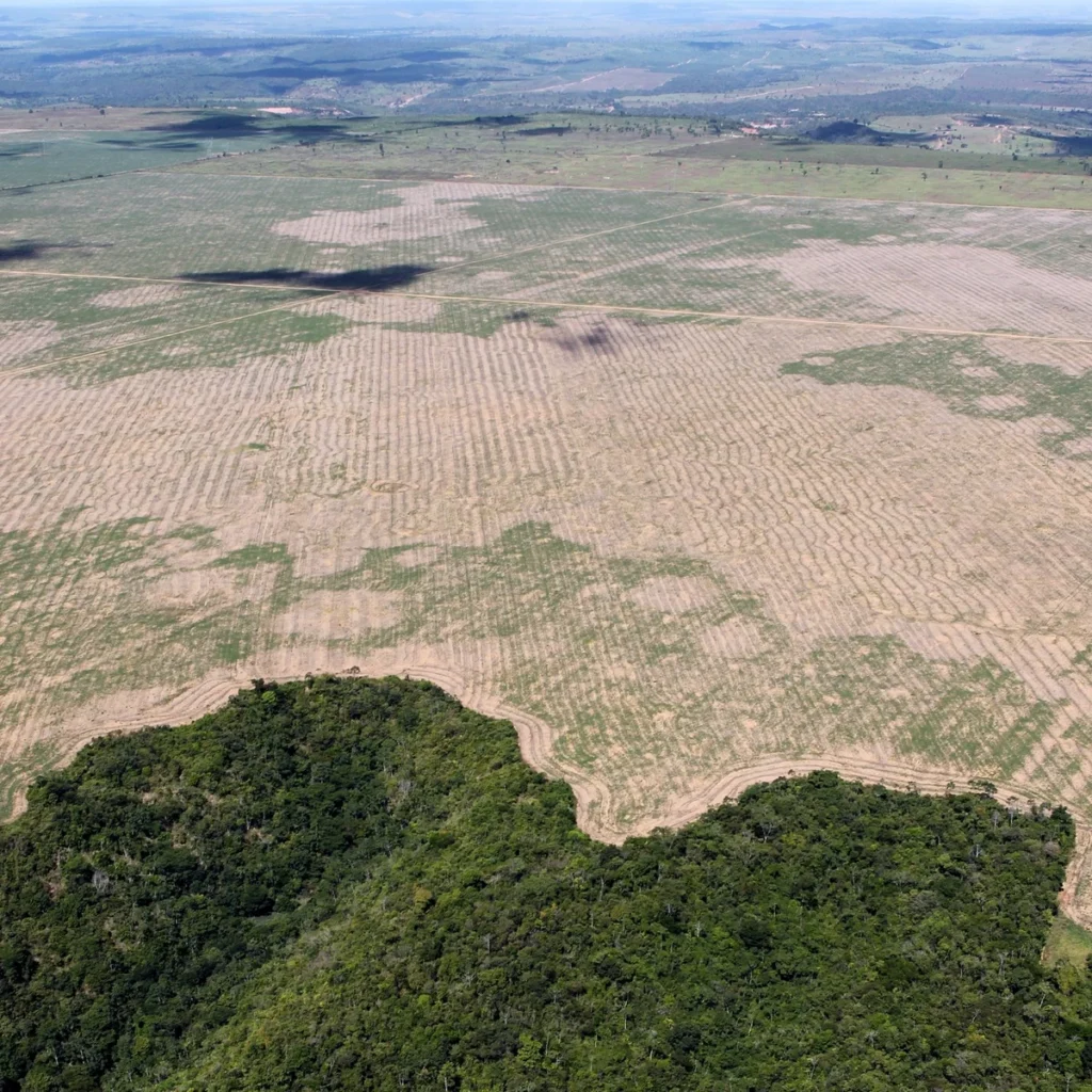
In parts of the Gurupi Biological Reserve in Maranhão, northeastern Brazil, forest gave way to grass. Other sites have burned. Even neighboring plots can need different kinds of help. Since November 11, a team from the Museu Paraense Emílio Goeldi has been collecting evidence about what helps or hinders recovery in each area.
The museum announced the expedition on November 20. It is part of the Restaura Gurupi-Awá project, which aims to put restoration measures in place across 560 hectares of the reserve and the Awá Indigenous Territory by 2030. The current field assessment took place in the reserve, not on Indigenous land. The aim is to get recovery under way; the forest will take much longer to recover.
What do researchers measure before planting?
The study calls for 26 plots, or marked areas where the team takes the same measurements. Researchers sample soil down to 20 centimeters and again at depths of 20 to 40 centimeters to assess fertility. Other samples help them assess soil compaction. Above ground, the team records native plants, grass cover and how much of the ground is shaded by tree canopies.
When is planting the best option?
The measurements guide that decision. A plot with little native vegetation may need more seedlings. Where young trees are already growing, filling gaps or introducing missing species may make more sense. The researchers also plan to measure intact forest plots so that they have a reference for tracking recovery.
Counting seedlings tells only part of the story. Over time, the team can look for more native species and vegetation cover to see whether the forest is returning.
Cover photo: Archive image of deforestation in the Gurupi region in 2016, not the current expedition. Felipe Werneck/Ascom Ibama via Wikimedia Commons, CC BY 2.0. Cropped for the cover.
Usamos cookies em nosso site para fornecer a melhor experiência de uso, lembrando suas preferências e visitas repetidas. Ao clicar em “Aceitar”, concorda com a utilização de TODOS os cookies.
Este site usa cookies para melhorar sua experiência enquanto você navega pelo site. Destes cookies, os cookies que são categorizados como necessários são armazenados no seu navegador, pois são essenciais para o

funcionamento das funcionalidades básicas do site. Também usamos cookies de terceiros que nos ajudam a analisar e entender como você usa este site. Esses cookies serão armazenados em seu navegador apenas com

o seu consentimento. Você também tem a opção de bloquear esses cookies. Porém, a desativação de alguns desses cookies pode afetar sua experiência de navegação.
Os cookies necessários são absolutamente essenciais para o funcionamento adequado do site. Esta categoria inclui apenas cookies que garantem funcionalidades básicas e recursos de segurança do site. Esses cookies não armazenam nenhuma informação pessoal.
Quaisquer cookies que possam não ser particularmente necessários para o funcionamento do site e sejam usados especificamente para coletar dados pessoais do usuário por meio de análises, anúncios e outros conteúdos incorporados são denominados cookies não necessários. É obrigatório obter o consentimento do usuário antes de executar esses cookies no seu site.