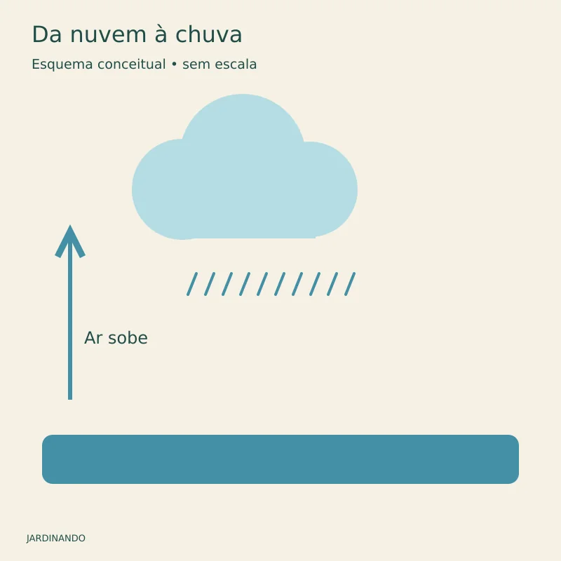
Sometimes the sky stays gray for hours without a drop reaching the ground. At other times, a cloud that seemed small grows and transforms the afternoon. To understand the difference, follow water from its invisible gaseous state to precipitation.
A cloud is not visible water vapor
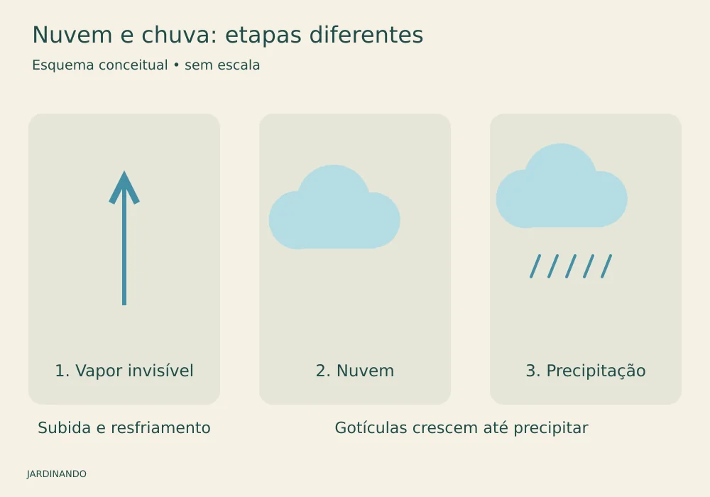
Water vapor is an invisible gas. The white or gray part of a cloud consists of tiny droplets and, depending on temperature, ice crystals. When moist air rises, it encounters lower pressure, expands, and cools. On reaching saturation, some vapor can condense onto tiny particles in the atmosphere.
This is why humidity alone does not guarantee rain. Conditions must favor the formation and growth of cloud particles. Many remain small; others evaporate before reaching the ground.
How a tiny droplet becomes rain
In relatively warm clouds, droplets collide and merge into larger drops. In the cold parts of many clouds, ice crystals also contribute to precipitation growth and may melt on the way down. Even small particles are already affected by gravity. As they grow, they fall faster relative to the air and have a better chance of passing through the cloud and reaching the ground, although updrafts may carry them for a while. Temperatures along the route influence what ultimately reaches the surface.
Why might a cloud produce no rain at ground level?
Forming a cloud and producing rain are different stages. Sometimes the droplets do not grow enough. In other cases, precipitation leaves the cloud but passes through dry air and evaporates before reaching the surface. Streaks of precipitation that disappear along the way are called virga, as explained in the US National Weather Service glossary.
This explains a familiar sight: a curtain of rain in the distance while the garden stays dry. Besides evaporation, rain may simply be falling elsewhere in the landscape. There is no automatic connection between a cloud we see and water arriving at our address.
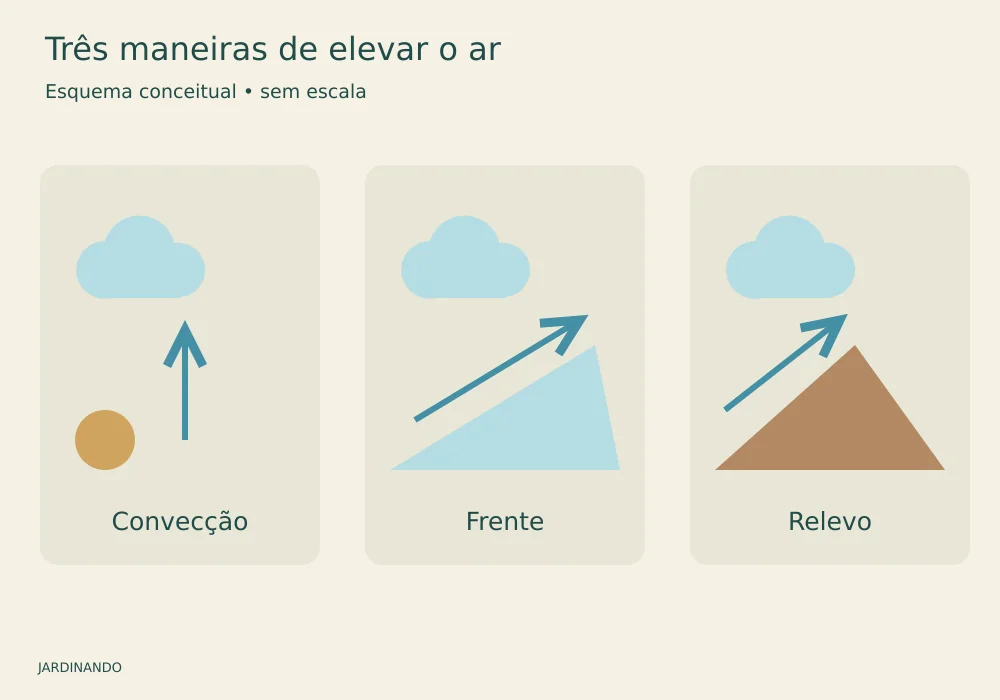
Three ways air rises
Convective rain: heating at the surface can encourage air to rise. With enough moisture and instability, vertically growing clouds and showers develop. Not every hot day ends in a thunderstorm.
Frontal rain: where air masses meet, warmer air may be lifted. Frontal systems can organize extensive areas of rain, but duration and intensity vary.
Orographic rain: terrain forces air up a slope. With sufficient moisture, cooling favors clouds and precipitation. The other slope may be drier, depending on circulation.
These categories describe mechanisms, not completely separate boxes. A front meeting a mountain range may combine lifting by terrain with convection.
What a cloud’s shape reveals
Layered clouds suggest a different structure from vertically growing towers. Cumulus clouds resemble heaps of cotton; stratus clouds form blankets; cirrus clouds are high and delicate, consisting mainly of ice. Cumulonimbus clouds extend far vertically and are associated with thunderstorms.
Observation helps us notice changes, but a single photograph cannot tell us how much rain will fall at a particular address. Altitude, wind, and changes over time also matter.
Showers or continuous rain: what changes?
Showers tend to start and stop more abruptly, with rapid changes in intensity. Rain from an extensive cloud layer tends to be more continuous. This describes precipitation behavior, not just its strength: a shower can be light, while persistent rain can accumulate a great deal of water. The Met Office explains this distinction through cloud structure.
What does 10 millimeters of rain mean?
One millimeter of rain equals one liter of water per square meter. So 10 mm means 10 liters on each square meter of a horizontal surface, before accounting for runoff, infiltration, and evaporation. A fully exposed horizontal bed measuring 2 m² would receive 20 liters if rainfall were uniform. This relationship is presented by Cemaden Educação.
Time matters. Ten millimeters in a few minutes reaches the ground faster than the same total spread over many hours. When comparing records, note both the total and the measurement interval. Do not confuse accumulated depth, in millimeters, with intensity, expressed for example in millimeters per hour.
It rained. Can I skip watering?
Check the pot, not just the pavement. Eaves may shelter a plant, leaves may divert water, and a small container receives rain only over its own opening. A weather station’s total does not guarantee that the potting mix was thoroughly wetted.
After rain, check moisture at a depth relevant to the plant, along with drainage. If the mix remains moist, adding water out of habit may prolong waterlogging. A sheltered, dry pot may still need watering. The decision depends on the species and container, not simply on clouds overhead.
A simple garden observation
On days without a thunderstorm risk, record the sky from the same spot, the time, and what happens afterward. Keep “the sky darkened” separate from “it rained here.” This diary helps avoid a common misconception: a dark cloud is not a reservoir about to overflow. Its appearance also depends on cloud thickness and how much light passes through.
If you hear thunder, stop observing outdoors and seek suitable shelter. Learning about clouds improves your understanding of the landscape; it does not replace weather warnings.
Sources and further reading
INMET: basic meteorology
NOAA: how clouds form
NOAA: what makes it rain
Met Office: rain and showers
Cover image: From cloud to rain. Original AI-assisted illustration; conceptual diagram, not to scale.